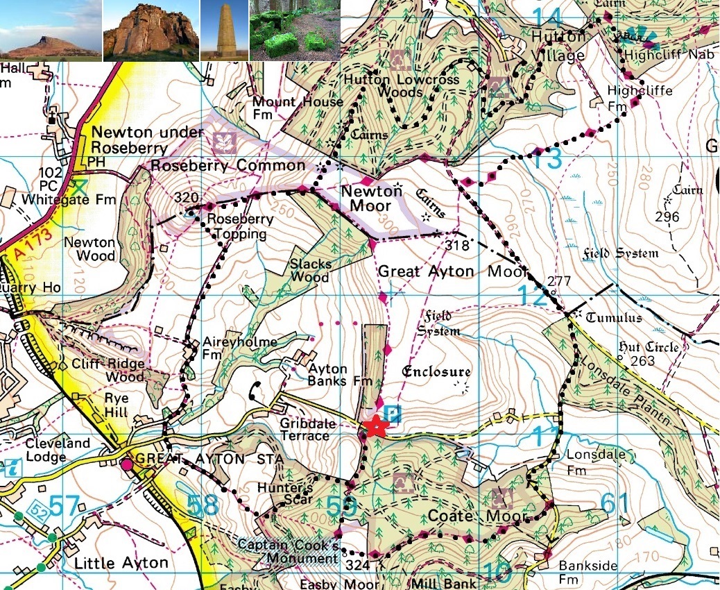
Roseberry Topping : 14th March - The suggested 10 mile [black] anti-clockwise route (with 1300ft of ascent) includes parts of the Cleveland Way and combines woodland and moorland walking along the escarpment of the Cleveland Hills. From the summit of Roseberry Topping (1,050ft), there are spectacular views of the North Yorkshire Moors National Park and across the Tees Valley as far as the Pennines. Roseberry Topping is an unusual landmark on the otherwise fairly level skyline of the North York Moors. A hard sandstone cap has protected the underlying soft shales and clays, so while the surrounding area was worn away by ice, wind and rain, the Topping survived. Its dramatically shaped summit (seemingly cut away on one side) has another explanation, at least in part. Alum, jet and ironstone have all been quarried and mined out of the hill over the centuries, and ironstone mine workings led to the collapse of the western face in 1912.